WEATHER SERVICE UPDATE — SUNDAY, OCTOBER 11
Heavier rain is possible through 10 p.m. Give the road—and the water—more room.
Rockland County Emergency Management says steady rain, gusty winds and possible thunderstorms may bring localized flooding, ponding and reduced visibility Sunday. The County puts the heavier-rain window between 4 and 10 p.m.
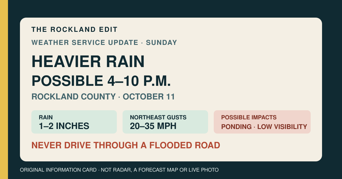
What the County says to expect
- Heavier rain: possible from 4 to 10 p.m.
- Rain total: 1–2 inches, with locally higher amounts possible.
- Wind: northeast gusts of 20–35 mph are possible.
- Thunderstorms: possible heavy downpours, lightning and gusty winds; severe storms are not expected.
- Potential impacts: localized flooding, water ponding on roads and reduced visibility.
5:50 p.m. correction: no warning-level change
- New City point forecast: the current 3:33 p.m. NWS page states one-tenth to one-quarter inch for the rest of the afternoon.
- Tonight: another one-half to three-quarters of an inch is possible, with gusts up to 20 mph.
- County caution: Rockland Emergency Management's broader 1–2 inch countywide estimate and 4–10 p.m. heavier-rain window remain unchanged.
- Why the numbers differ: the NWS figures are a point forecast for New City split by forecast period; the County figure is a broader countywide storm estimate.
- Correction note: an earlier version of this page said one-quarter to one-half inch for the afternoon. The current NWS page does not support that figure.
If you need to drive
Allow extra time, slow down for visibility and standing water, and never drive through a flooded roadway. Water can hide a washed-out surface or be deeper than it looks. If a road is blocked, follow police, fire or highway directions rather than trying to pass the closure.
Before leaving, check the live 511NY incident list ↗. Conditions can change after this page's 5:50 p.m. check.
This is a caution update—not a warning notice
The National Weather Service's 3:33 p.m. New City forecast calls for rain this afternoon and mainly before midnight. Its regional Hazardous Weather Outlook says the probability of widespread hazardous weather is low, and Rockland County's emergency page listed no active alert or warning at the time of this update.
Those facts do not rule out a flooded low spot, a downed branch or a later warning. They mean this page should not be read as a flood watch, flood warning, severe-thunderstorm warning or confirmation that a particular road is closed.
What changes for a resident: If you are traveling in Rockland Sunday afternoon or evening, plan around the 4–10 p.m. heavier-rain window, allow extra time and do not drive through a flooded road.
Primary sources checked October 11, 2026, at 5:50 p.m. EDT: Rockland County Fire and Emergency Services' Sunday weather update ↗; the National Weather Service New City forecast ↗, updated at 3:33 p.m.; the NWS Hazardous Weather Outlook ↗, issued at 2:42 a.m.; Rockland County's emergency-alert page ↗; and all three pages of the 511NY incident list ↗. The 5:50 p.m. correction replaces an earlier unsupported afternoon amount; it does not imply NWS changed the 3:33 p.m. issuance time. County potential impacts are forecast possibilities, not independently observed flooding, road closures, wind damage or outages.